0
D
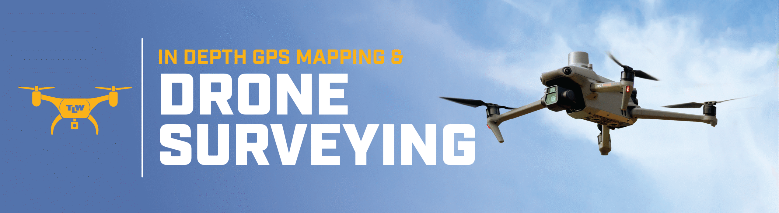
Our Drones are equipped toCapture Every Detail
At TL Wallace, our Drone & Aerial Mapping Division combines advanced UAV platforms, specialized sensors, and GIS integration to deliver high-precision data that drives better decisions. Whether it’s LiDAR topography, orthophotos, thermal inspections, or 3D models, we provide a complete suite of aerial solutions that improve accuracy, cut field time, and enhance project safety.
Drone SurveyingCapabilities
Rapid Aerial Mapping
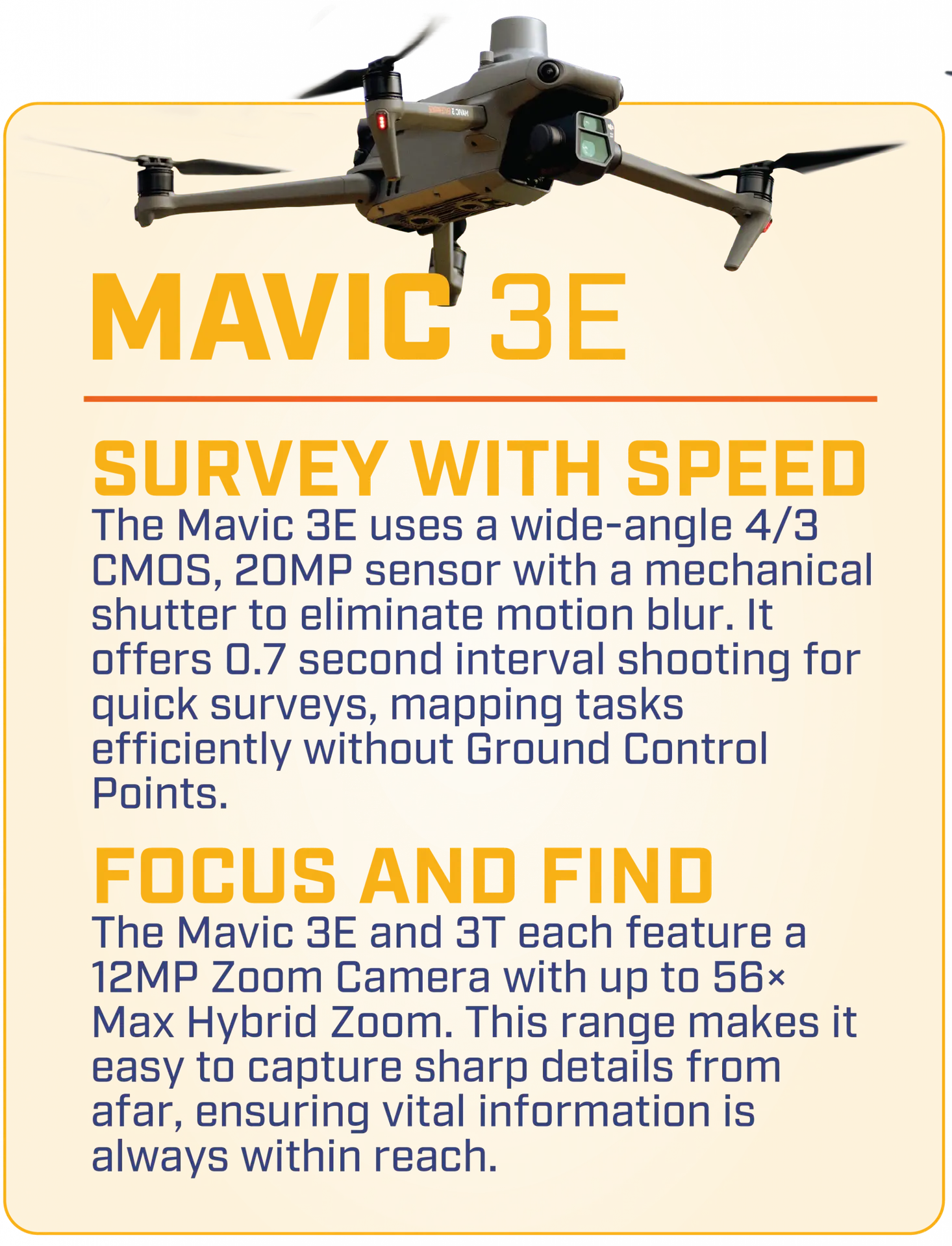
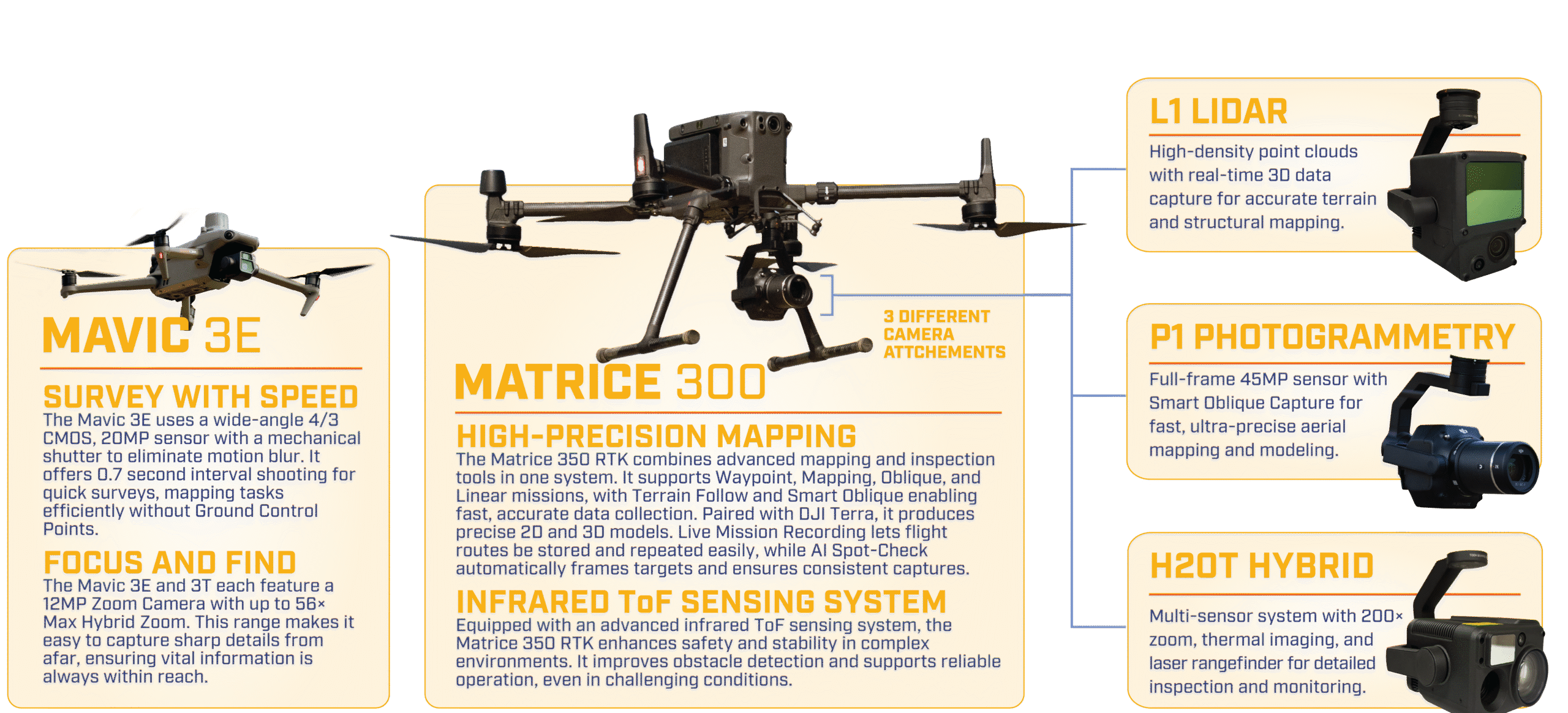
Mavic 3E enables fast deployment and high-speed image capture, delivering accurate site maps and progress updates without relying on ground control points.
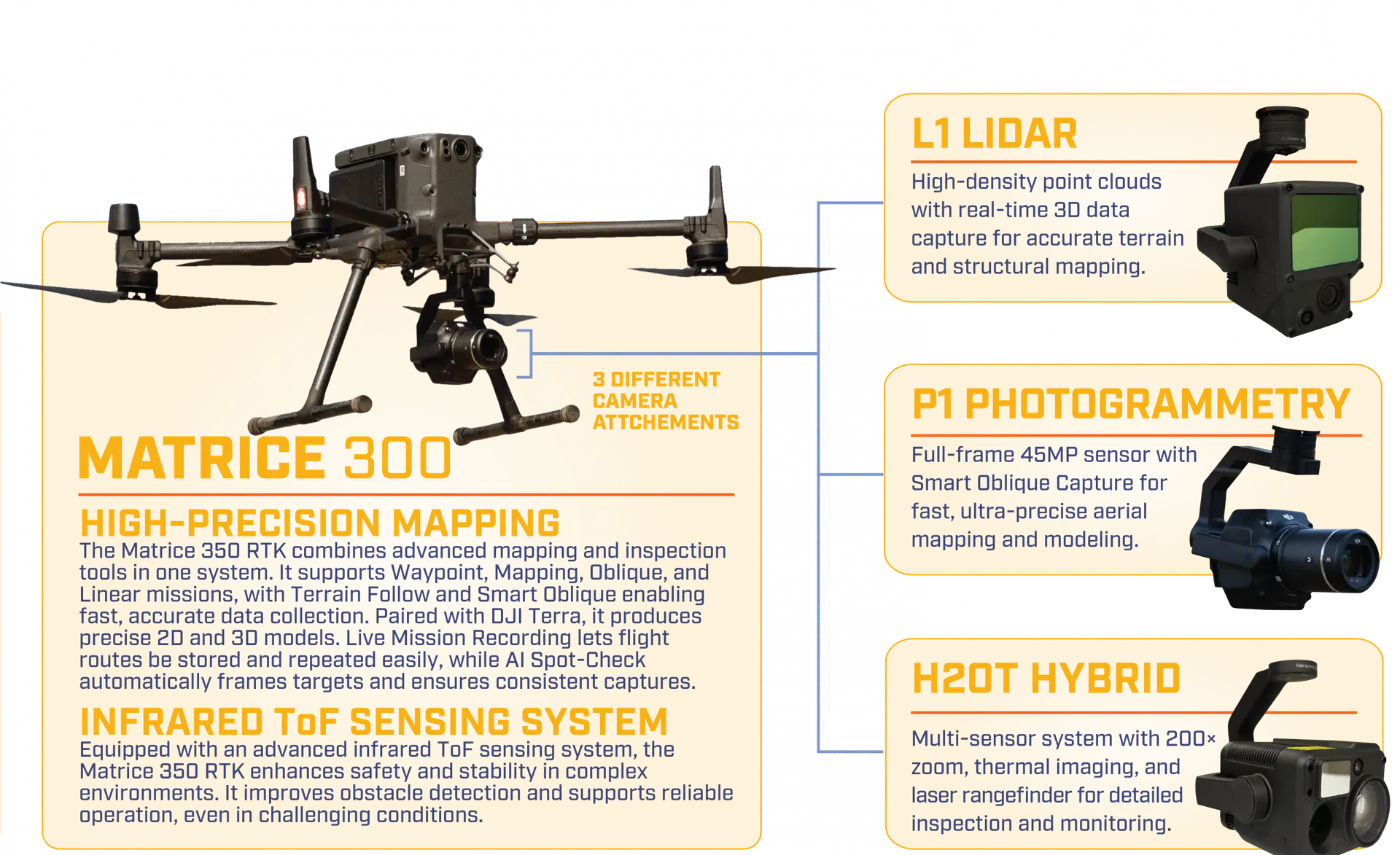
LiDAR & Photogrammetry
Advanced sensors like the L1 and P1 provide dense point clouds and survey-grade imagery, processed into 2D orthomosaics and 3D models for design and construction.
Thermal & Visual Inspections
The H20T hybrid system combines thermal imaging, zoom, and laser rangefinding to detect issues such as heat loss, water intrusion, or equipment failures.
Automated Flight Accuracy
RTK positioning with AI Spot-Check and Live Mission Recording ensures centimeter-level precision and consistent, repeatable datasets.
At TL Wallace, our Mapping & Engineering services deliver the critical data and visual intelligence needed to guide projects from concept through completion. By blending advanced technology with expert analysis, we help clients make informed decisions, optimize resources, and ensure projects are completed on time and within budget.
Let us tell you about the tl wallace
Drone Surveying Advantage
Scalable Precision
Our fleet adapts to projects of any size, from small utility corridors to multi-square-mile infrastructure sites.
Automated data collection reduces survey times by up to 70% compared to traditional fieldwork.
0
km2
Covered in a single day
Matrice 300 with P1 camera system covers up to 7.5 km² in a single day, delivering results at unmatched scale.
Time & Cost Savings
Automated data collection reduces survey times by up to 70% compared to traditional fieldwork.
Building a Clearer View
From the sky
At TL Wallace, our drone technology isn’t just about flying cameras—it’s about delivering measurable value at every stage of a project. By combining UAV platforms with advanced sensors, we produce high-resolution data faster and more accurately than traditional methods. This efficiency translates into meaningful savings, reduced risk, and better project outcomes. Our clients gain a competitive edge by receiving the information they need in hours instead of days, keeping projects on track and budgets under control.
Drone SurveyingServices
Topographic Mapping
Capture terrain data and create detailed elevation models that support planning, grading, and infrastructure design.
Construction Progress Tracking
Provide repeatable aerial surveys to document jobsite changes and keep stakeholders updated in real time.
Structural & Utility Monitoring
Use drone inspections to safely assess infrastructure, utilities, and hard-to-reach areas without disrupting operations.
Integrated GIS Solutions
Deliverables include grading plans, custom figures, and GIS database updates, with seamless integration into platforms like Propeller Aero.
Check out Some Of Our
Camera AttAchments
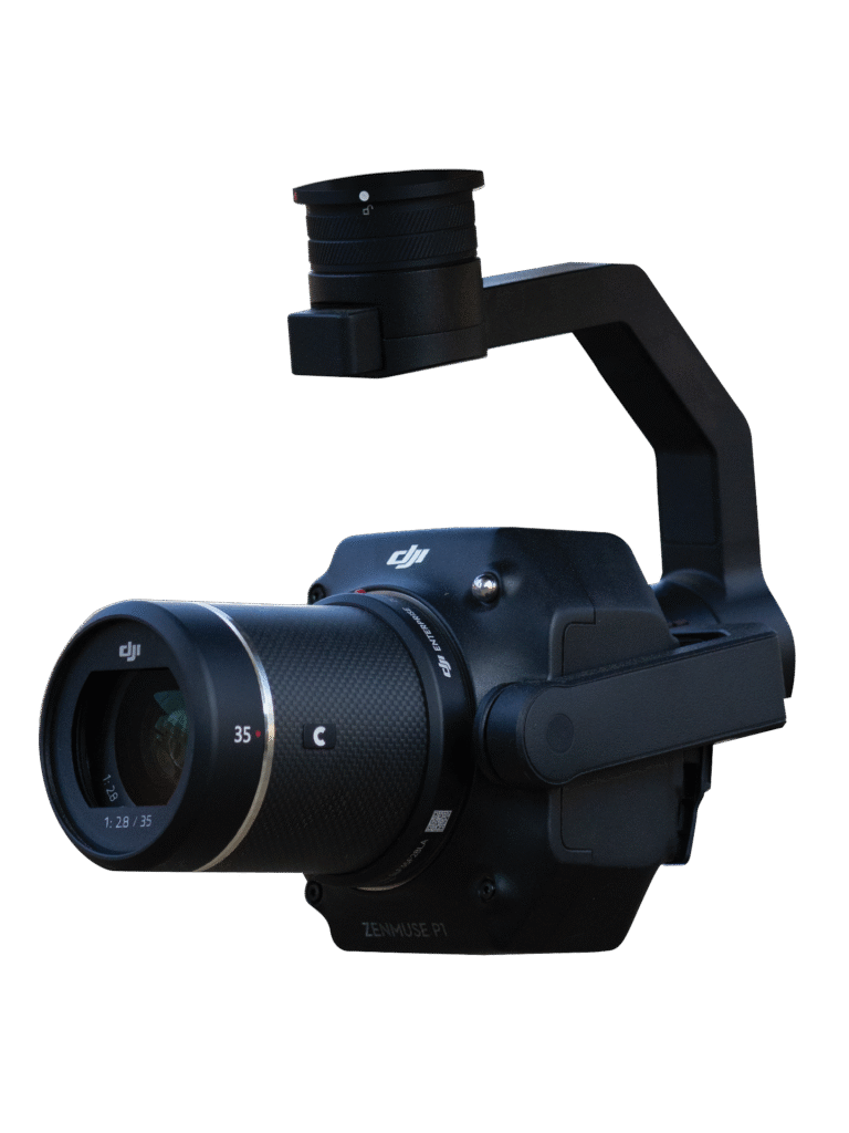
P1 Photogrammetry
The P1 Photogrammetry sensor combines a 45-megapixel full-frame camera with interchangeable lenses, making it ideal for large-area mapping and detailed visual documentation. Its Smart Oblique Capture function automatically rotates the gimbal to capture images from multiple angles, cutting post-processing time by up to 50% while producing highly accurate 3D reconstructions and orthomosaics.
With the ability to capture an image every 0.7 seconds and cover up to 7.5 km² in a single day, the P1 excels in efficiency and scale. This allows TL Wallace to complete large survey projects faster than ever before, all while maintaining survey-grade accuracy. The deliverables—whether they are high-resolution orthophotos, construction progress updates, or 3D models—integrate seamlessly into existing design and planning workflows.
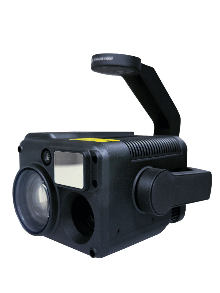
H20T Hybrid
The H20T Hybrid sensor is a multi-sensor powerhouse, combining RGB imaging, thermal vision, and a 200× hybrid zoom into a single gimbal. This versatility makes it one of the most effective tools for inspections, monitoring, and specialized missions where multiple data types are required. The ability to switch seamlessly between thermal and visual views allows teams to identify issues such as heat loss, water intrusion, or electrical malfunctions with pinpoint accuracy.
Whether used for infrastructure monitoring, search and rescue, or environmental assessments, the H20T delivers detailed and actionable data in a way that saves both time and resources. It allows TL Wallace to provide clients with not only imagery, but also the insights needed to maintain safety, ensure compliance, and plan effective responses to challenges in the field.
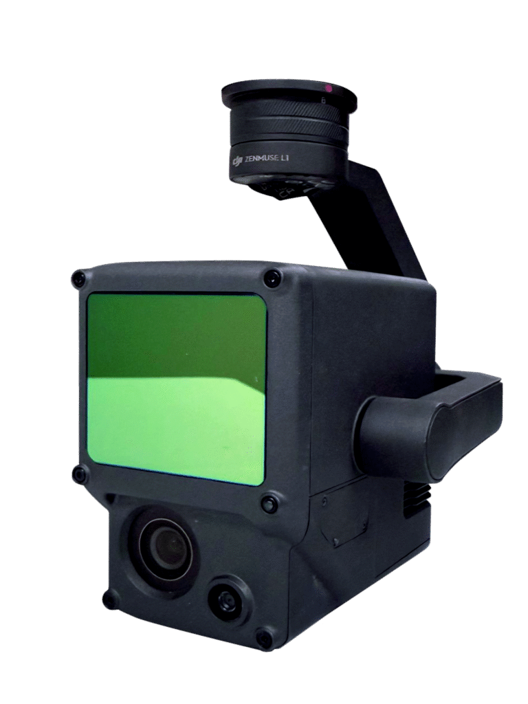
L1 LiDAR
The L1 LiDAR payload is designed to deliver high-density point clouds and real-time 3D data capture, making it an indispensable tool for topographic surveys and terrain modeling. By using laser scanning technology, the L1 can penetrate dense vegetation and complex landscapes to create accurate digital elevation models that traditional surveying methods often miss. This gives engineers, designers, and contractors the ability to see the true shape of the land, no matter how challenging the environment.
The L1 is especially valuable for large-scale infrastructure projects, where precision and efficiency are critical. From roadway grading to drainage analysis, the accuracy of the LiDAR point cloud supports design, planning, and quality control throughout the entire construction process. It’s not just a surveying tool—it’s a way to reduce risk and ensure the success of complex, high-value projects.
P1 Photogrammetry
The P1 Photogrammetry sensor combines a 45-megapixel full-frame camera with interchangeable lenses, making it ideal for large-area mapping and detailed visual documentation. Its Smart Oblique Capture function automatically rotates the gimbal to capture images from multiple angles, cutting post-processing time by up to 50% while producing highly accurate 3D reconstructions and orthomosaics.
With the ability to capture an image every 0.7 seconds and cover up to 7.5 km² in a single day, the P1 excels in efficiency and scale. This allows TL Wallace to complete large survey projects faster than ever before, all while maintaining survey-grade accuracy. The deliverables—whether they are high-resolution orthophotos, construction progress updates, or 3D models—integrate seamlessly into existing design and planning workflows.
H20T Hybrid
The H20T Hybrid sensor is a multi-sensor powerhouse, combining RGB imaging, thermal vision, and a 200× hybrid zoom into a single gimbal. This versatility makes it one of the most effective tools for inspections, monitoring, and specialized missions where multiple data types are required. The ability to switch seamlessly between thermal and visual views allows teams to identify issues such as heat loss, water intrusion, or electrical malfunctions with pinpoint accuracy.
Whether used for infrastructure monitoring, search and rescue, or environmental assessments, the H20T delivers detailed and actionable data in a way that saves both time and resources. It allows TL Wallace to provide clients with not only imagery, but also the insights needed to maintain safety, ensure compliance, and plan effective responses to challenges in the field.
L1 LiDAR
The L1 LiDAR payload is designed to deliver high-density point clouds and real-time 3D data capture, making it an indispensable tool for topographic surveys and terrain modeling. By using laser scanning technology, the L1 can penetrate dense vegetation and complex landscapes to create accurate digital elevation models that traditional surveying methods often miss. This gives engineers, designers, and contractors the ability to see the true shape of the land, no matter how challenging the environment.
The L1 is especially valuable for large-scale infrastructure projects, where precision and efficiency are critical. From roadway grading to drainage analysis, the accuracy of the LiDAR point cloud supports design, planning, and quality control throughout the entire construction process. It’s not just a surveying tool—it’s a way to reduce risk and ensure the success of complex, high-value projects.
Ready toBuild Your Vision?
At TL Wallace, we have the stability, experience, and resources to successfully deliver your next large-scale commercial construction project. Our seasoned team, coupled with our extensive network of trusted subcontractors, ensures your project is in capable hands from start to finish.
If you’re ready to break ground on your next commercial project, we’re ready to help. Contact us today by filling out our contact form through the link below so we can start making your vision a reality.
TL Wallace
Building the Future, One Structure at a Time